| Portable GPS/Desktop-GIS for Fire
Management Support:
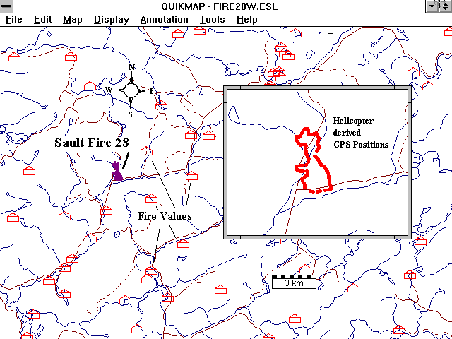
The project team completed the
development and implementation of a portable
GPS/desktop-GIS for fire operations in a jointly
sponsored project by Forestry Canada and the
Ontario Ministry of Natural Resources. The
project involved the use of ground and
helicopter-borne GPS to provide quantitative
information, decision support, and a quicker
response time for the District Fire Offices. |
|
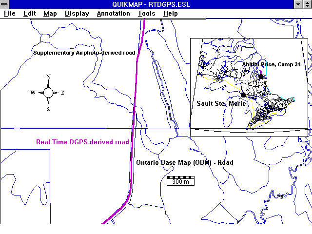
| Real-Time
DGPS and GPS Tracking & Mapping for Natural
Resource Applications:
This project was a follow-up to the
project 'Portable GPS/Desktop-GIS for Fire
Management'. The project consisted of using GPS
and Desktop-GIS for various natural resouce
applications utilizing higher accuracies and the
use of data telemetry between the base station
and remote location. The range of operation in
various terrain conditions was evaluated along
with the field accuracy of the survey. The
project was funded in part by the Northern
Ontario Development Agreement, Northern Forestry
Program, and involved Natural Resources Canada
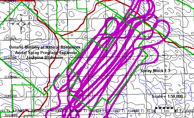
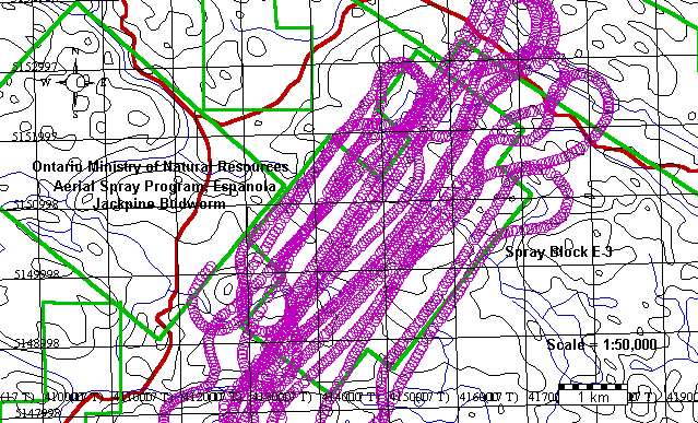
and the Ministry of Natural Resources. An example
of an aerial spraying application using DGPS is
shown in figure 1: aerial spray track (polyline) and figure 2: aerial spray
track (DGPS points). |
|
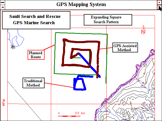
| GPS Mapping
System for Search and Rescue Operations: The project team completed trial tests
using the portable GPS/desktop-GIS technology
with the Sault Ste. Marie Search and Rescue Unit
(SSAR). ELIRIS is engaged in a cooperative
arrangement with SSAR to test and demonstrate the
application of GPS/desktop-GIS technology for
search and rescue operations on land, air, and
water. |
|
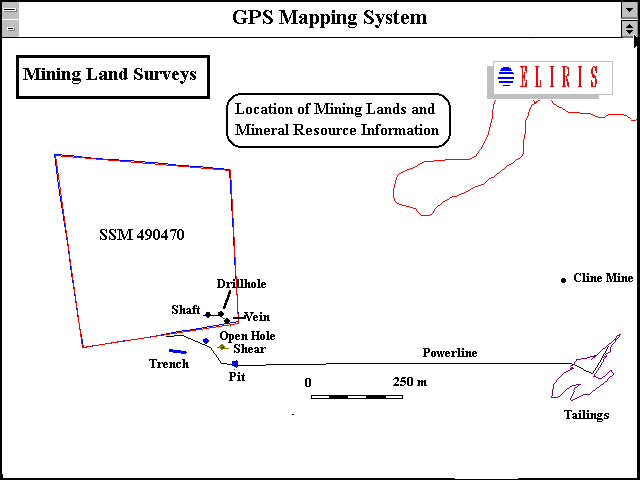
| GPS/Desktop-GIS
for Mining Lands/Mineral Resource Inventory: A series of trial
applications were completed by members of the
Project Team using GPS/desktop-GIS applied to
common functions in the mineral resource sector.
This included a GPS survey of a patented claim,
location of mineral deposits, mine shafts &
workings, tailings sites, trenches and pits on a
mining property. In addition, several roads were
surveyed using GPS followed by the transfer of
the data to desktop-GIS for comparison with
1:250,000 and 1:20,000 (digital and hardcopy)
geographic basemaps. |
|