 GIS Consulting Services
 Desktop-GIS Applications for Mineral Exploration: The Project Team undertook a contract with a major mining and exploration company to set up a pilot project using desktop-GIS to handle geoscience data compilations and analytical functions which had been primarily manual in nature. This involved training, education, and technical support; ELIRIS continues to provide the company with technical and data processing services. The mining company will be using the results of this pilot project to guide future decisions in the acquisition of information technology for geoscience applications.
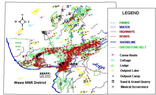
Mineral Resource/Landuse Management Information Systems: The project team completed a mineral resource/land use management information system for the Ministry of Northern Development and Mines. This involved the compilation of values and mineral resource data for the Wawa area (values information was obtained from the MNR Wawa and Hearst Districts). Databases were designed and data entered consisting of resource values, land uses, environmental sensitivities, mineral deposits, geochemical samples, sand & gravel quarries, etc.
All the digital data was entered into a desktop-GIS from which a series of maps with a report were produced displaying the location of areas of high mineral potential and various resource values and areas of environmental sensitivity. This data was later acquired by Ontario Hydro for a study of the proposed hydro-electric corridor from Manitoba.
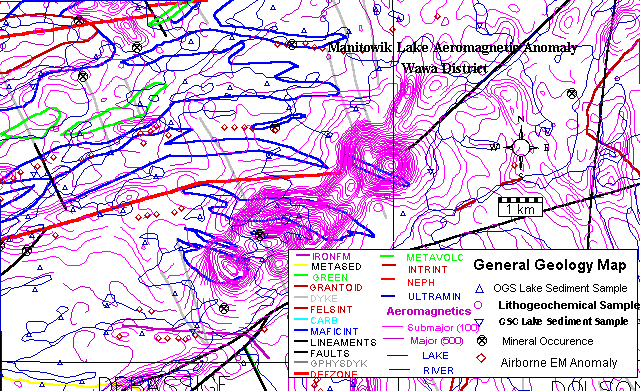
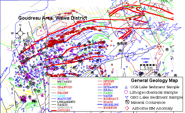
Integrated Geoscience Information System: Members of the project team completed a compilation of digital geoscience information for the Wawa area over a period of two years. This involved the use of desktop-GIS technology and consisted of acquiring /transferring /processing /digitizing various sources of information into a digital format; these data included various geoscience and geographic basemaps, and mineral resource databases. The result from the project was a readily available geoscience information system, the use of which required a small learning curve. A series of maps and a database reports were produced which are available within the District Office for public use.