Geoscience Data IntegrationAt the reconnaissance scale, a variety of geoscience information can be evaluated in order to determine regional and local scale target areas for further study. The most useful data sources at the reconnaissance scale are provincial databases such as lake sediment and water geochemistry, rock geochemistry, drill hole databases, mineral deposit inventories, generalized geological maps and geophysical surveys. At the regional scale, provincial databases can be supplemented with regional lake sediment and water geochemical surveys, overburden geochemistry, regional geology, assessment file index, and geophysical surveys. At the local scale, provincial and regional databases can be supplemented with detailed local geology, Ontario Base Maps (drainage, topography, transportation), detailed geochemical surveys and assessment file indexes. Company proprietary information can also be incorporated at the local scale. The intent of the various scales of analysis is to identify areas with geological, geophysical and geochemical anomalies which may be indicative of economic mineral concentrations. Verification of anomalies from more than one data source serves to priorize the results and thereby provides a guide for further analysis and/or exploration/target identification. |
MethodologySome of the limitations on the use of available digital information for mineral exploration include the lack of standard formats, standard coordinate systems, and lack of spatial intelligence embedded in the digital data. Once the data are in a standard format suitable for a desktop-GIS environment, then it is a simple process to compile and overlay. We have endeavoured to provide this standard for both ArcView and MapInfo desktop-GIS environments for selected geoscience data and on a customized basis. |
Data AnalysisDesktop-GIS is now being used for a wide variety of applications ranging from environmental assessment to marketing. For mineral exploration desktop-GIS provides the means to statistically analyse and classify geochemical data, enhance geophysical images, determine spatial relationships between point, line, polygon features, and produce charts, tables and maps of the resulting analysis. We provide value-added analysis of government or proprietary data sets on a fee-for-service basis. |
|
Reconaissance Scale 1:250,000 (full image 31 Kb) : Distribution of anomalous Nickel (ppm) in rocks sampled by the Ontario Geological Survey (PETROCH database), northeastern Lake Superior, Hemlo-Michipicoten Area, Ontario. |
|
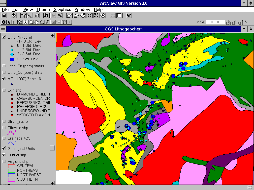
Regional Scale 1:50,000 (full image 47 Kb):
Distribution of anomalous Nickel (ppm) in rocks sampled by the Ontario Geological Survey
(PETROCH database), overlaid on geology and mineral deposits database, central
Michipicoten Greenstone Belt, Wawa District, Ontario. |
|
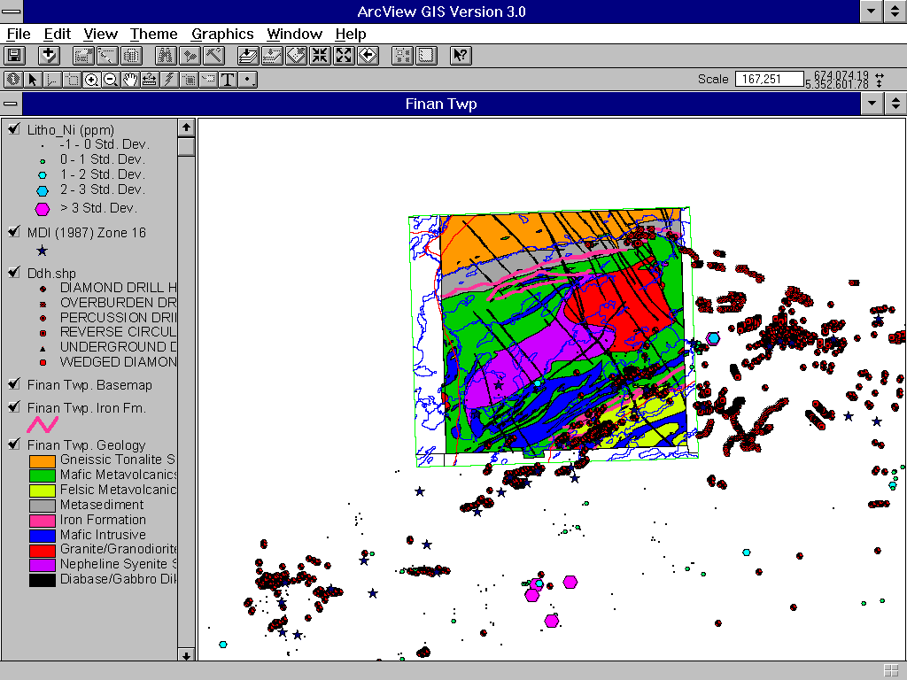
Local Scale 1:20,000 (full image 45 Kb): Distribution of anomalous Nickel (ppm) in rocks sampled by the Ontario Geological Survey (PETROCH database), overlaid on detailed geology, mineral deposits, and drill hole database, Finan Township (Wawa District, Ontario). |
|
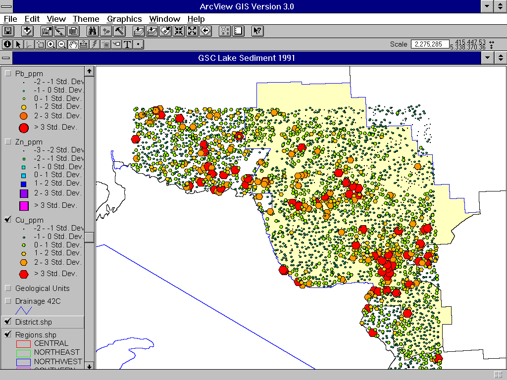
Reconnaissance Scale 1:250,000 (full image 57 Kb): Distribution of anomalous Copper in lake sediments, northeastern Lake Superior, Hemlo-Michipicoten area, Ontario. |
|
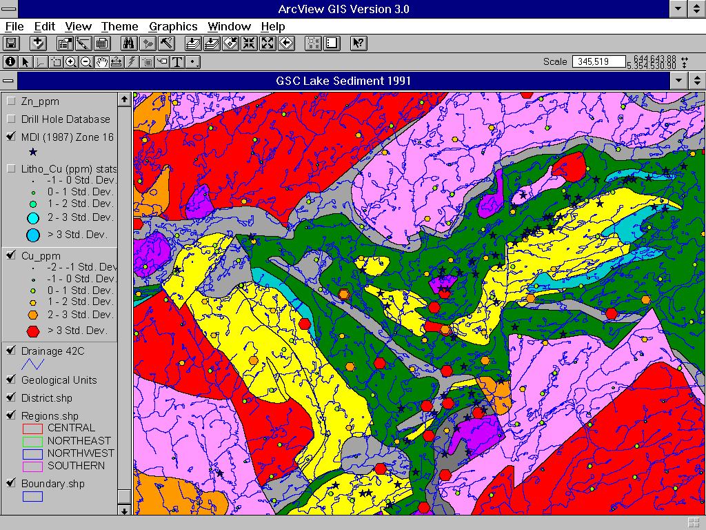
Regional Scale 1:50,000 (full image 83 Kb): Distribution of anomalous Copper in lake sediments overlaid on regional geology (east-central sheet), and Mineral Deposit Inventory database (MDI); central Michipicoten Greenstone Belt. Wawa District, Ontario. |
|
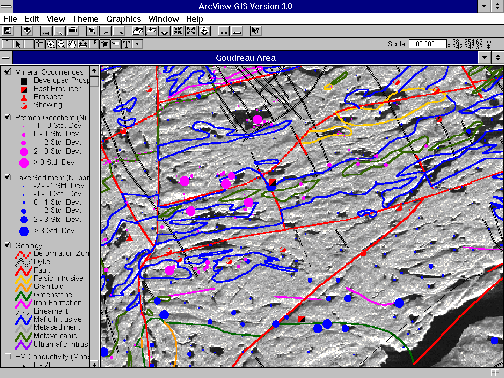
Local Scale 1:20,000 (full image 222 Kb): Distribution of anomalous Copper in lake sediments and anomalous Nickel on rocks, overlaid on regional geology, Mineral Deposit Inventory database (MDI), and SAR (radar) image; Goudreau area, central Michipicoten Greenstone Belt, Wawa District, Ontario. |
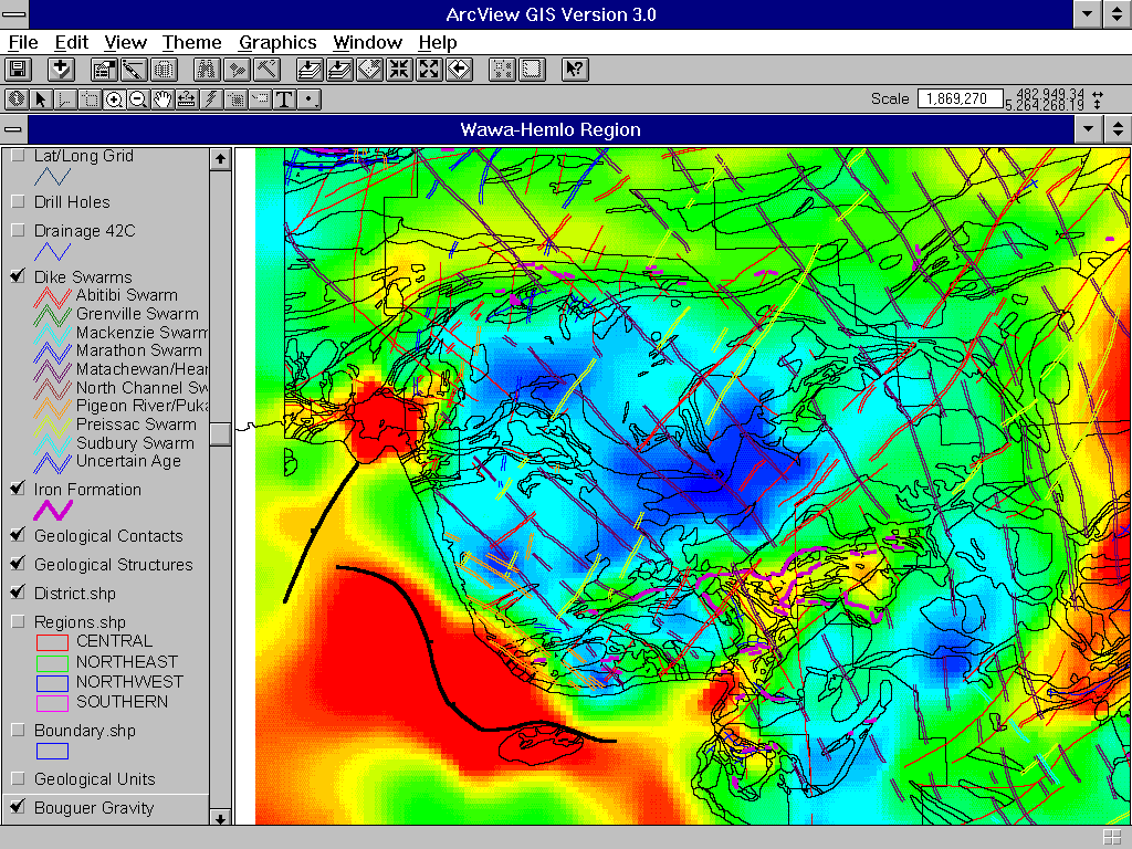 |
Reconnaissance Scale 1:250,000 (full image 146 Kb): Bouguer Gravity overlain by bedrock geology, east-central sheet), Hemlo-Michipicoten area, Ontario. |
 |
Regional Scale 1:50,000 (full image 151 Kb): Regional aeromagnetic survey overlain by regional geology (east-central sheet) and Mineral Deposit Inventory database, central Michipicoten Greenstone Belt, Wawa District, Ontario. |
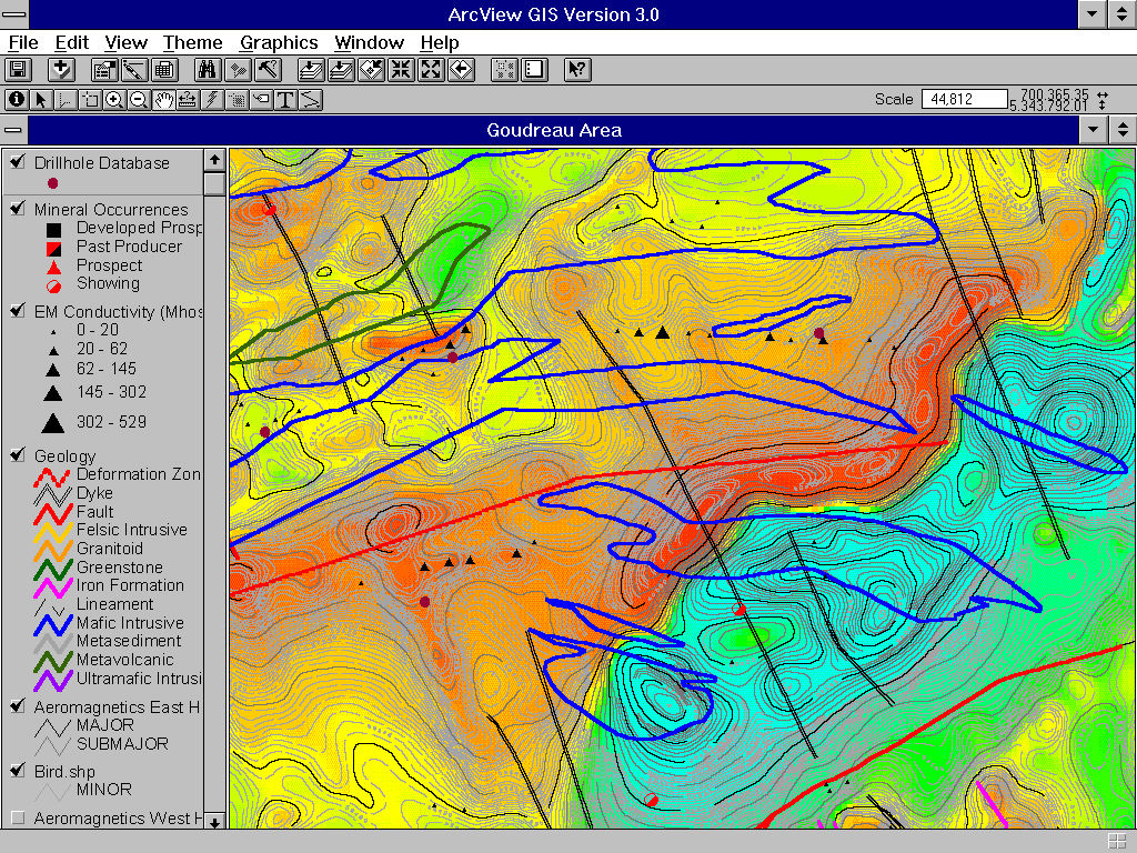 |
Local Scale 1:20,000 (full image 162 Kb): Aeromagnetic survey (coloured and contoured) overlain by regional geology, drill hole database, Mineral Deposit Inventory database, and airborne EM conductivity anomalies. |
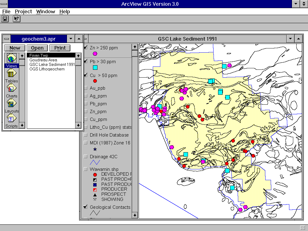 |
Reconnaissance Scale (1:250,000): Distribution of (highly) anomalous Zinc, Lead, and Copper in lake sediments overlaid on regional geology Hemlo - Michipicoten area, Ontario. |
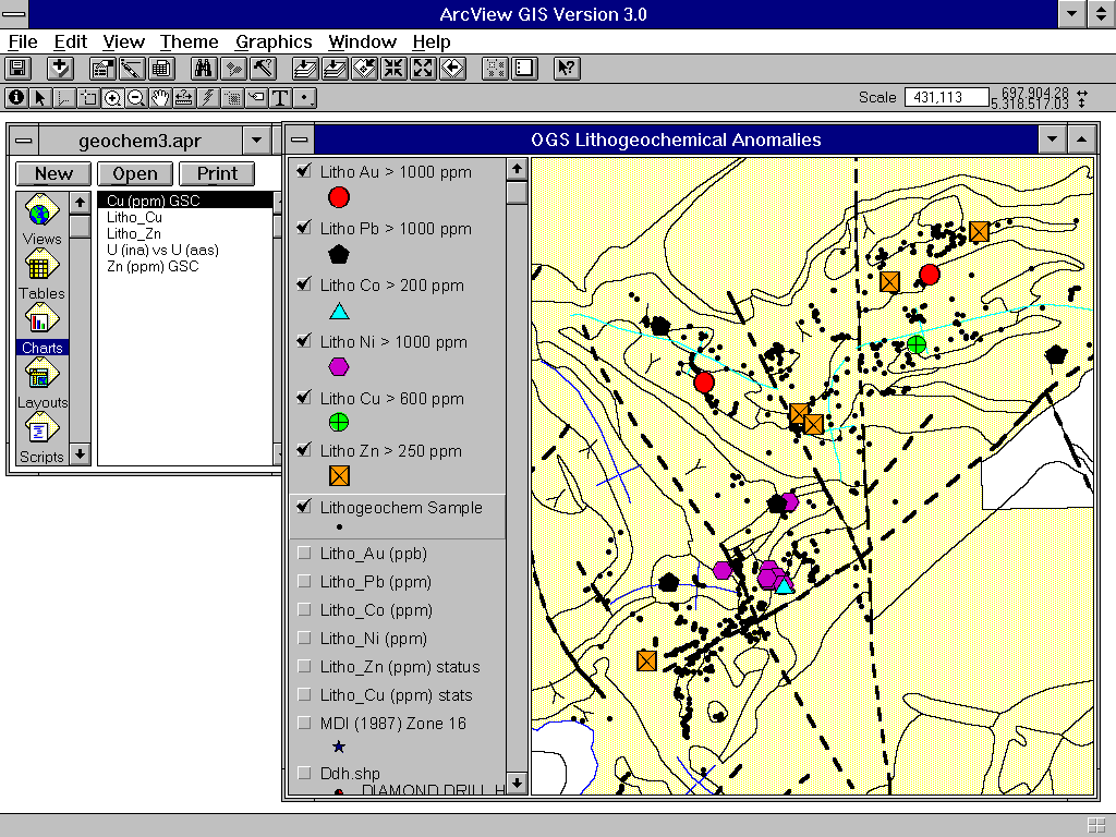 |
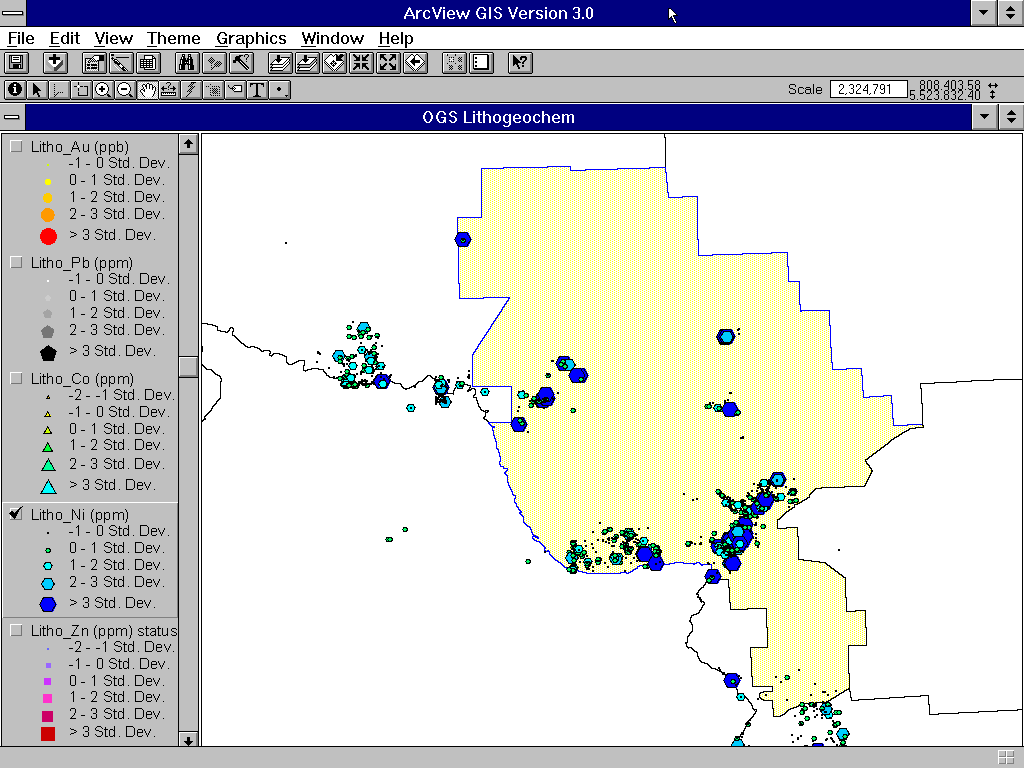
Regional Scale (1:50,000): Distribution of (highly) anomalous Gold, Lead, Cobalt, Nickel, Copper, and Zinc from OGS rock samples overlaid on regional geology (east-central sheet, central Michipicoten Greenstone Belt, Wawa District, Ontario. |
 |
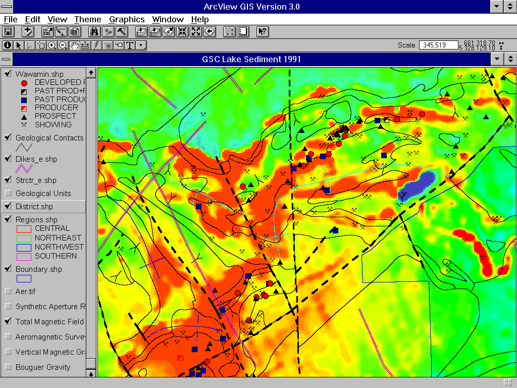
Local Scale (1:20,000): Aeromagnetic
survey (coloured and contoured) overlain by regional geology, drill hole database, Mineral
Deposit Inventory database, and airborne EM conductivity anomalies. Also shown are
lithogeochemical and lake sediment geochemical anomalies, selected drill holes and mineral
occurences. |