| Ancient Shorelines: A 1
billion years old shoreline along Lake Superior |
||
Photo Location
1 |
Map showing extent of Jacobsville Formation and Photo Locations
|
Photo Location 4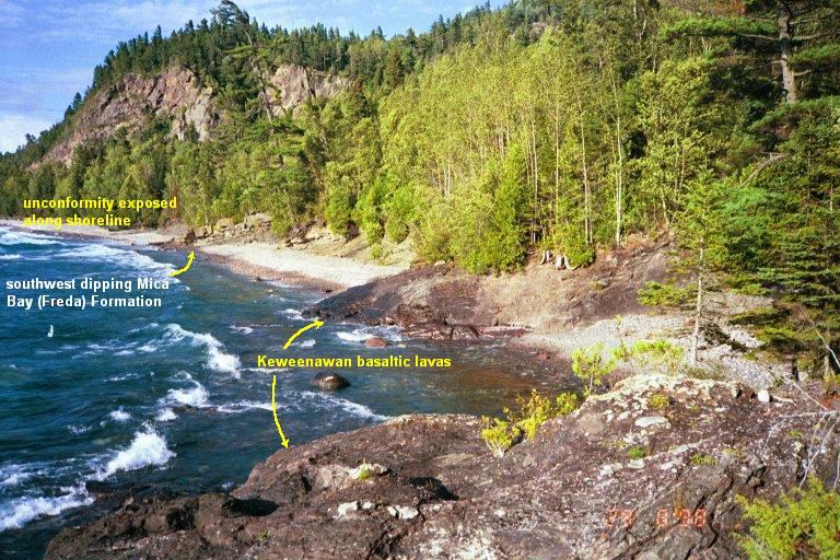 Photo Location 3 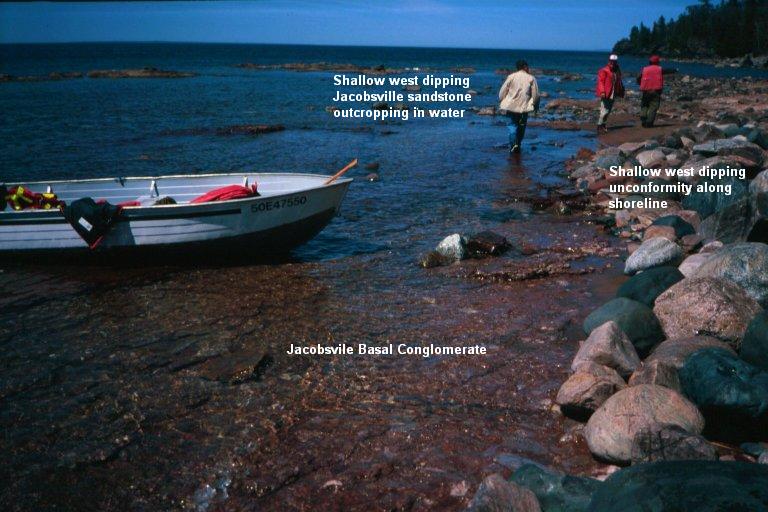 |
| Ancient Shorelines: A 1
billion years old shoreline along Lake Superior |
||
Photo Location
1 |
Map showing extent of Jacobsville Formation and Photo Locations
|
Photo Location 4 Photo Location 3 |
| Additional Photos | ||
Photo Location 3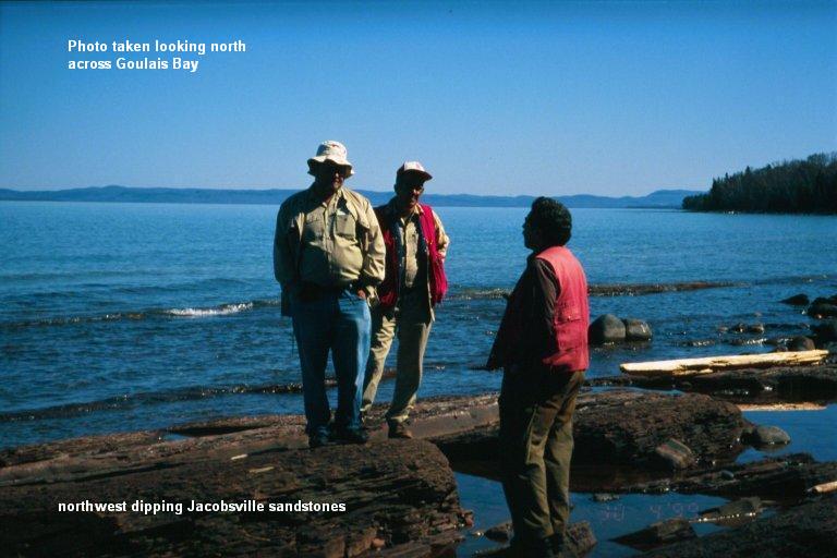 Standing on sandstone outcrop from left to right: Gerry Bennett, Paul Mora, Delio Tortosa; Mike Hailstone photographer. |
Photo Location 3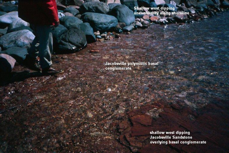 Close-up of shallow dipping Jacobsville sandstone overlying basal polymictic conglomerate; unconformity outcrops parallel to the shoreline. |
Photo Location 3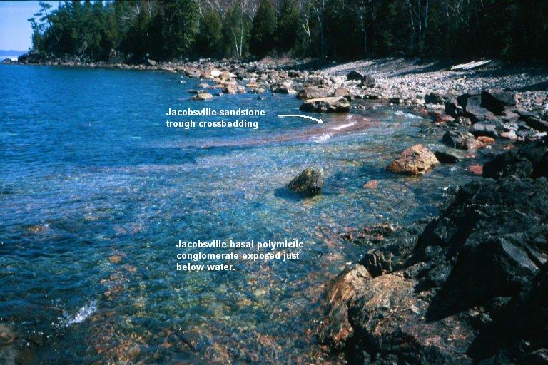 Shallow dipping Jacobsville sandstone overlies basal conglomerate; unconformity outcrops parallel to the shoreline. |
| Photo Location 3 Shallow west dipping Jacobsville sandstones overly a basal polymictic conglomerate visible just at water level. |
Photo Location 4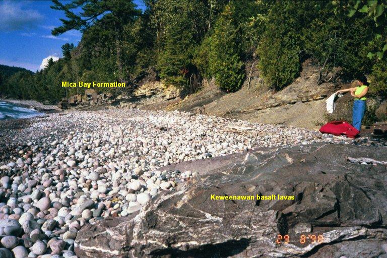 Mica Bay
Formation siltstones unconformably overlying Keweenawan basltic lavas. Mica Bay
Formation siltstones unconformably overlying Keweenawan basltic lavas. |
Photo Location 4 Close up of Mica Bay Formation siltstones unconformably overlying Keweenawan basltic lavas. |
| Ancient Shorelines Jacobsville Sandstone is well known around Lake Superior as a common architectural buildingstone of many towns and cities around the lake's perimeter. The red massive to cross-bedded sandstones underly the border cities of Sault Ste. Marie, Ontario and Michigan and is reflected in the construction of many churches and heritage buildings.
|
|
(same area as
Photo Location 1) |
Paleo Weathering Profile: (from Kalliokoski, GSA Memoir 156. 1982) Yellow: Jacobsville Formation Red: Unconformity surface Orange: Granodiorite Blue: Peridotite 1: Perodotite 2: Blocky peridotite, supergene chert 3: Granodiorite 4: Diabase dike 5a,b: incipient weathering 5c: leached horizon 5d: Chert-rich lag deposit 6: Jacobsville sandstone |
|
|
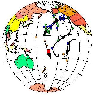 |
Logan Loop Paleomagnetic Trend (data from Halls and Pesonen, GSA Memoir 156, 1982) Samples represent paleomagnetic positions for sedimentary, volcanic, and intrusive rocks of the Lake Superior basin. Red square indicates location of Jacobsville sandstone. Using
paleomagnetic techniques, the 'travel path' of rocks that form the Lake Superior basin
have been reasonably well established and is referred to as the 'Logan Loop'. The
Jacobsville formation is positioned at the end of the loop with each point on the loop
representing a slightly younger age for the rocks. |
|
|
|
 Thickness of the Jacobsville Formation (from Hamblin, 1956) showing the 1000 feet (red), 100 feet (green) and 0 feet (blue) isopachs. The 0 isopach is assumed to be the approximate location of the sub-paleozoic Jacobsville unconformity. |
| Credits: References: |
|


